LICENSES & ENERGY INFRASTRUCTURE
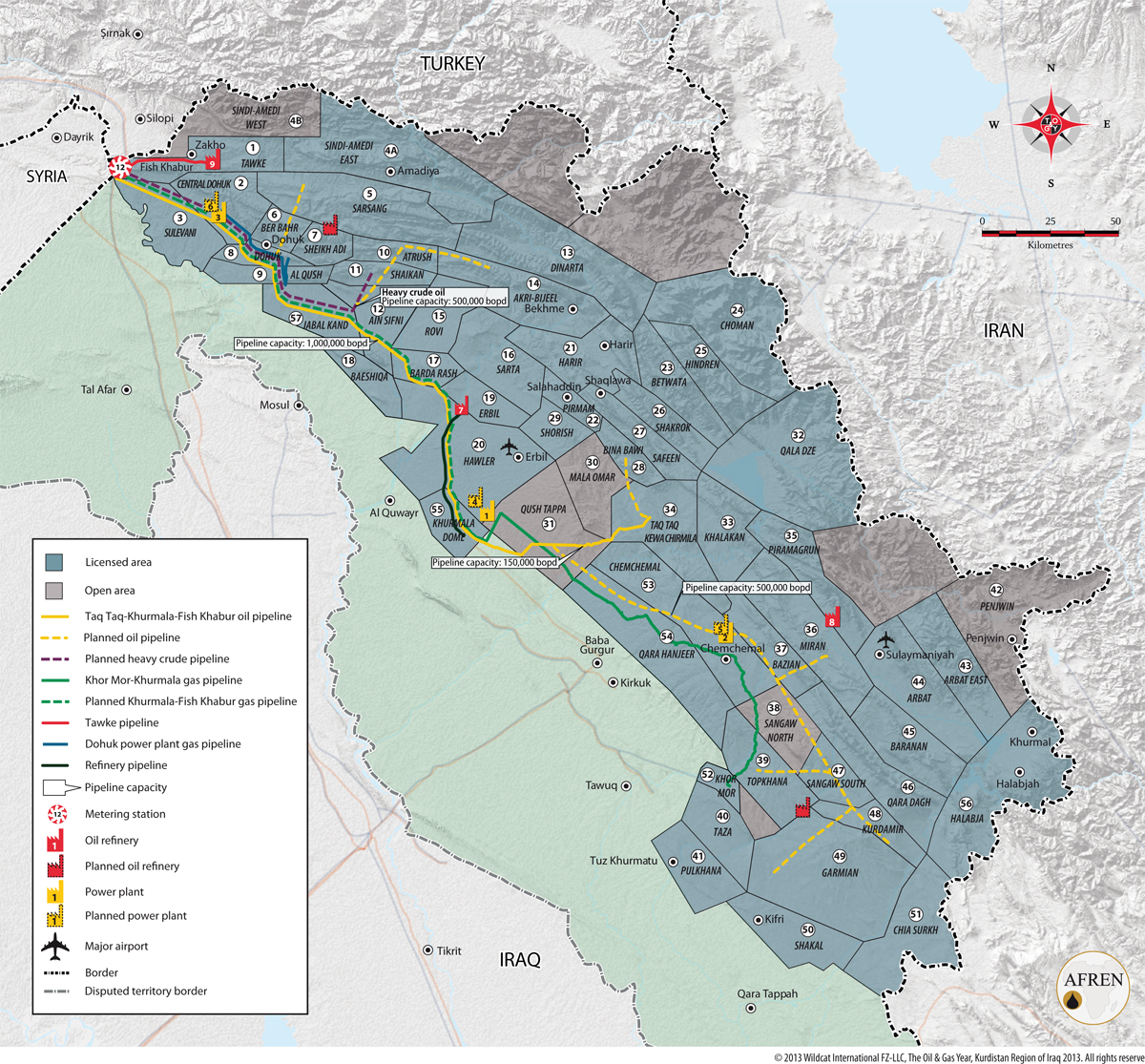
Download a PDF map of licences and energy infrastructure:
DOWNLOAD LICENCES AND ENERGY INFRASTRUCTURE PDF MAP
- Details
- Category: Maps-and-data
- Published: 23 July 2013
- Hits: 13578
DISCOVERIES AND DEVELOPMENT
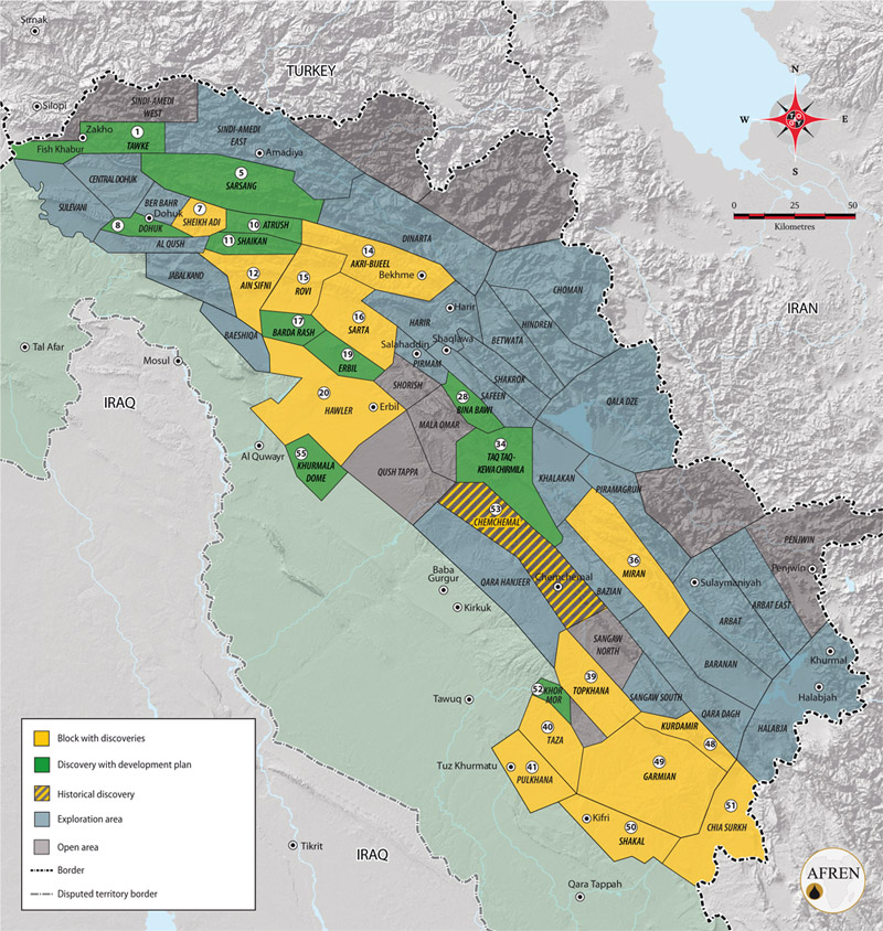
Download a PDF map of oil discoveries and development in the Kurdistan Region:
DOWNLOAD OIL DISCOVERIES AND DEVELOPMENT PDF MAP
- Details
- Category: Maps-and-data
- Published: 23 July 2013
- Hits: 9856
PIPELINE INFRASTRUCTURE
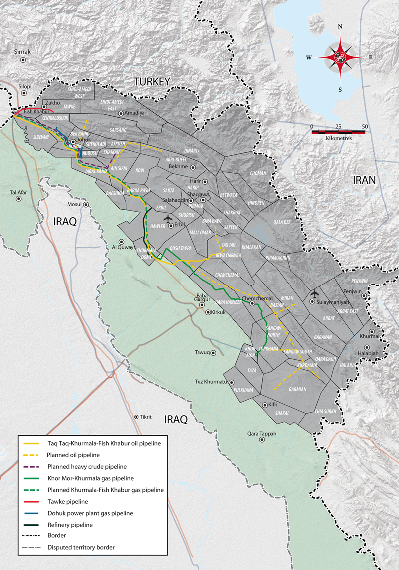
Download a PDF map of the Kurdistan Region's pipeline infrastructure and plans:
DOWNLOAD PIPELINE INFRASTRUCTURE PDF MAP
- Details
- Category: Maps-and-data
- Published: 09 September 2013
- Hits: 123124
STRUCTURAL DOMAIN
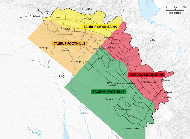
NORTHEASTERN SECTION
The northeastern section is known as the Taurus Mountains zone. The zone is characterised by a propensity to medium-to-heavy oil finds. Geologically, the area shows a relatively large range in recovery factors, a tendency to oil finds with large in-place resources and a low-to-medium exploration risk.
NORTHWESTERN SECTION
The northwestern section named the Taurus Foothills zone, is characterised by a tendency to heavy oil, a relatively low geological risk and large in-place resources. The Gulf Keystone-operated Shaikan field has demonstrated the area's potential.
SOUTHWESTERN SECTION
The southwestern section, the Zagros Footlhills zone, shows a high propensity to large oil and gas condensate fields. With a relatively low geological risk, the area has revealed a tendency to higher gas-to-oil ratios. The zone is in close proximity to a fair amount of existing infrastructure, for example the Kirkuk-Ceyhan pipeline.
SOUTHEASTERN SECTION
The southeastern section, the Zagros Mountains zone, shows a higher propensity to gas finds with less frequent oil shows. A mountainous area, it poses a number of operational challenges with medium to high technical risk and cost.
- Details
- Category: Maps-and-data
- Published: 23 July 2013
- Hits: 7738
FOLLOW US ON TWITTER
MAPS
